£20 - £40
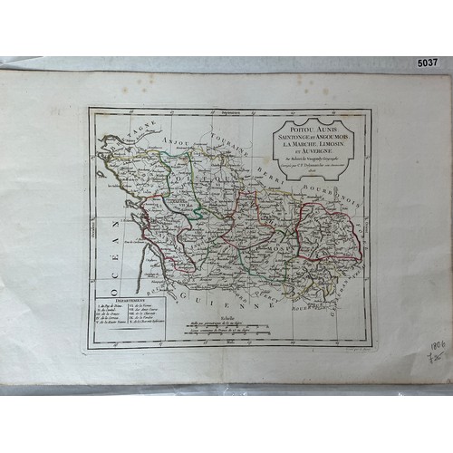
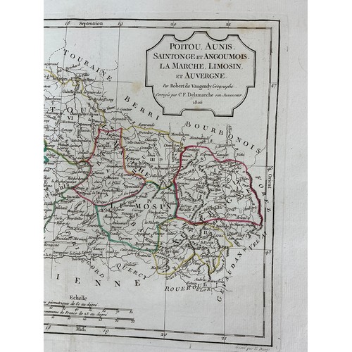
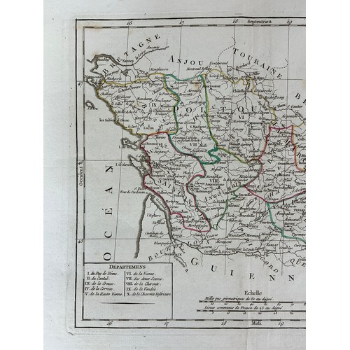
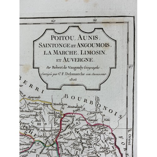
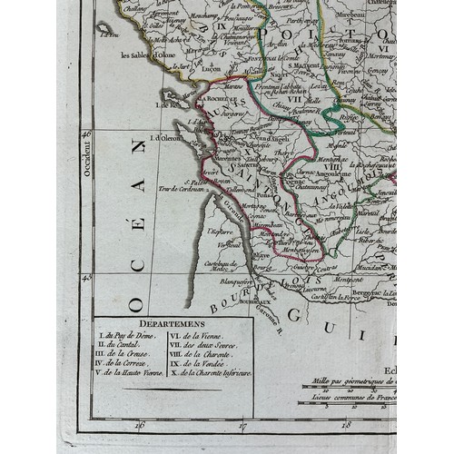
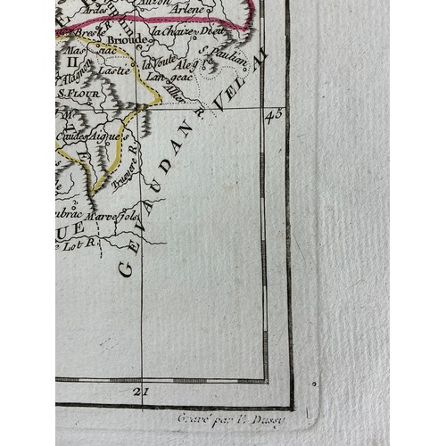
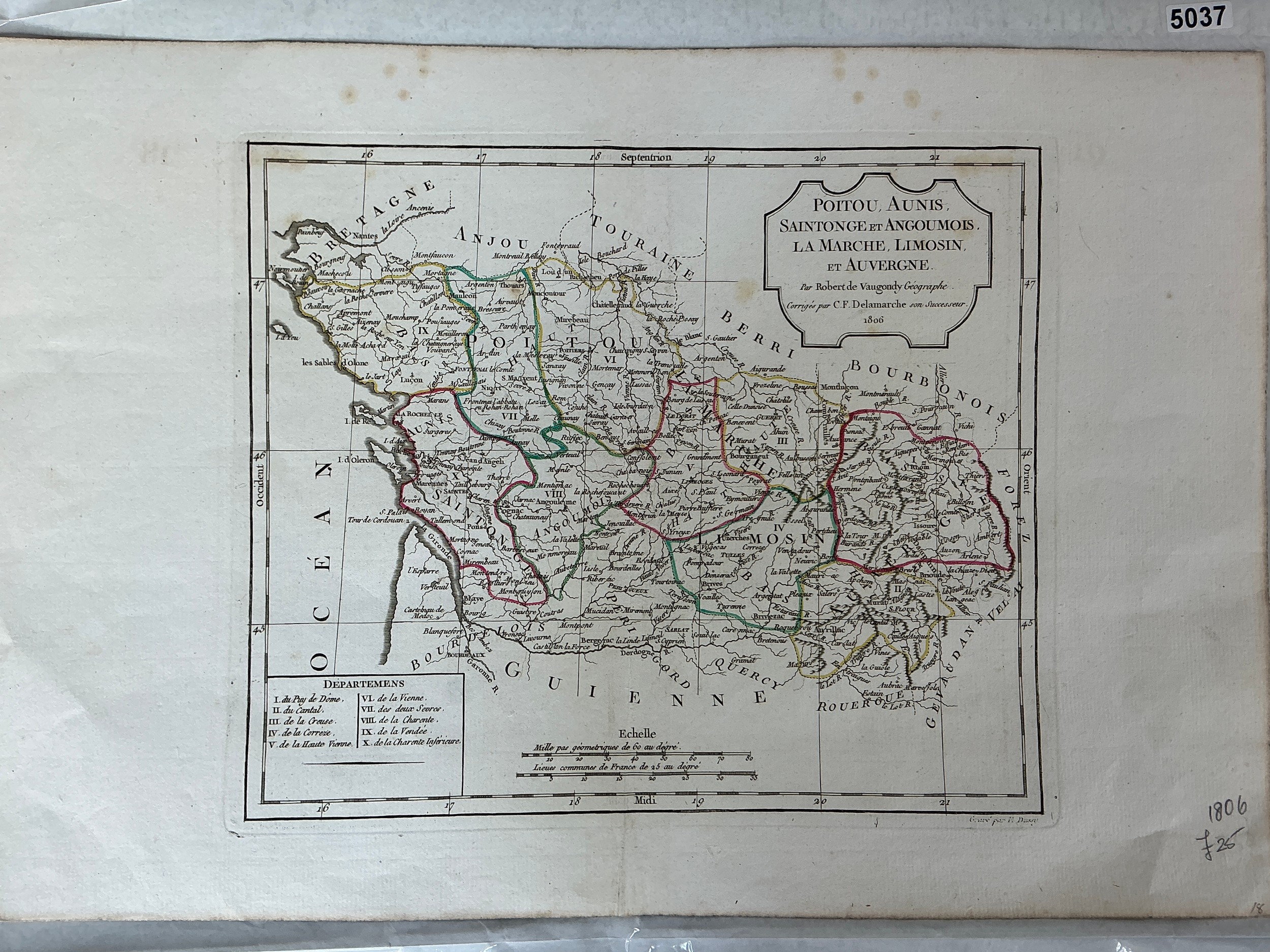
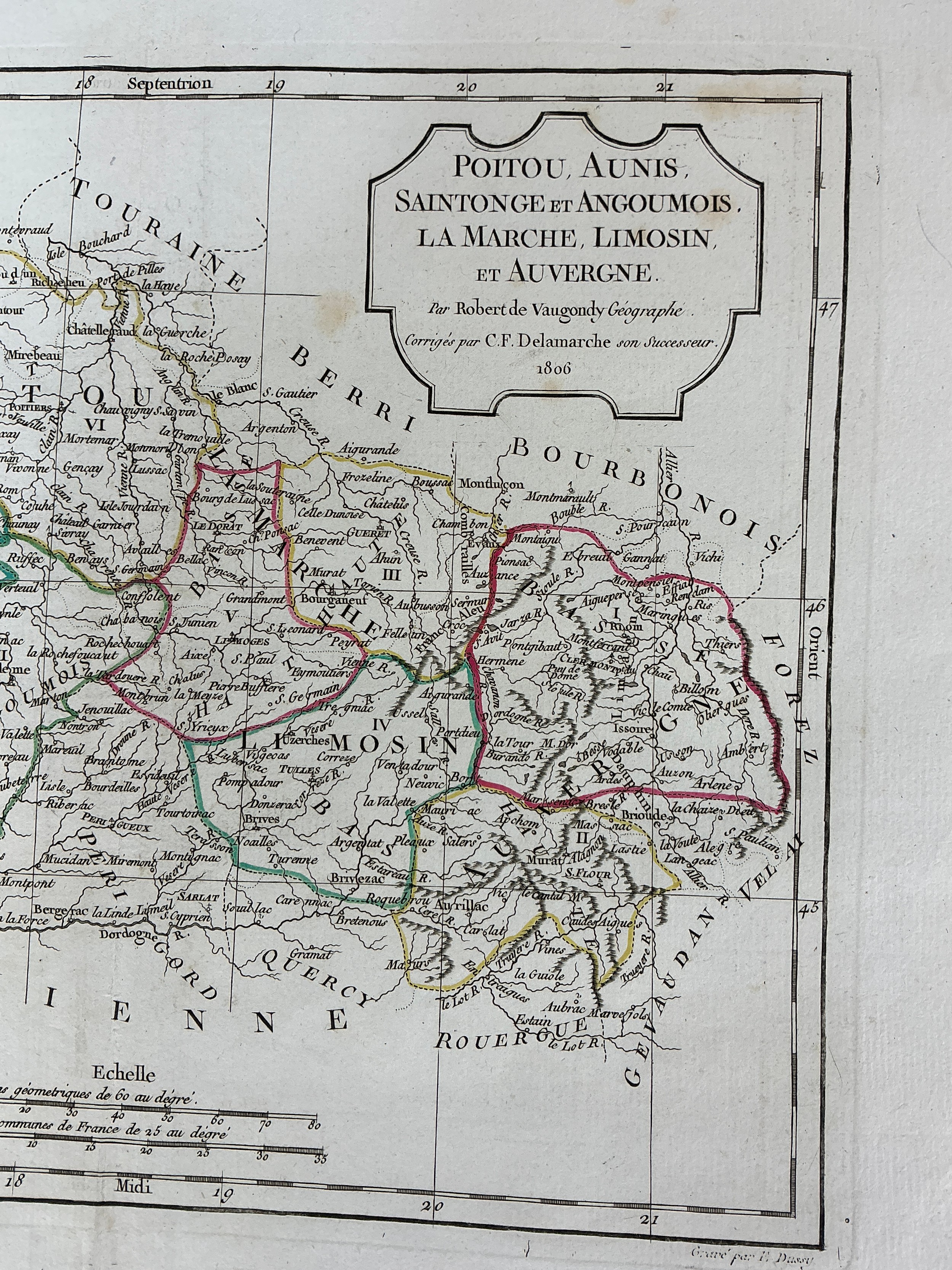
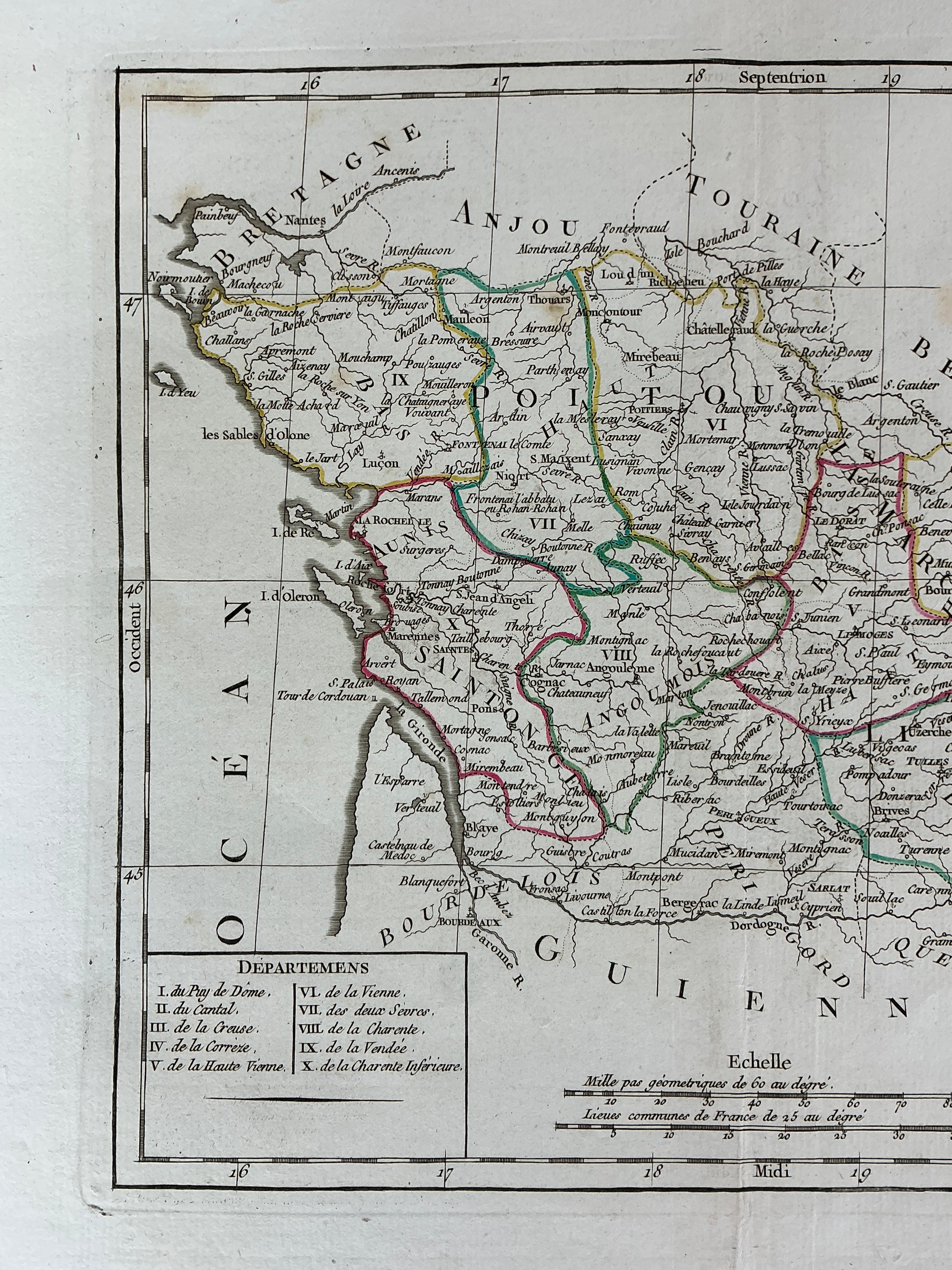
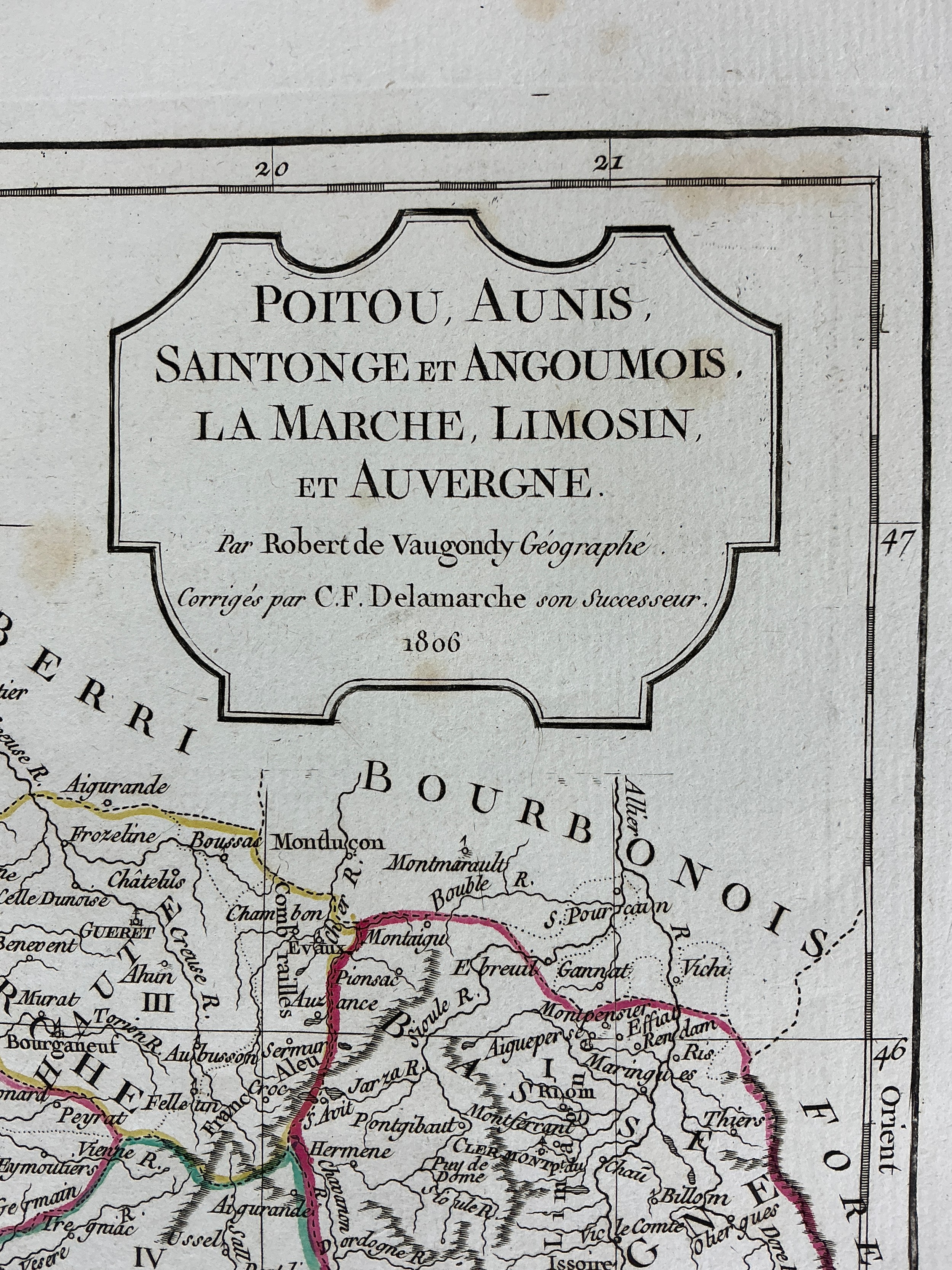
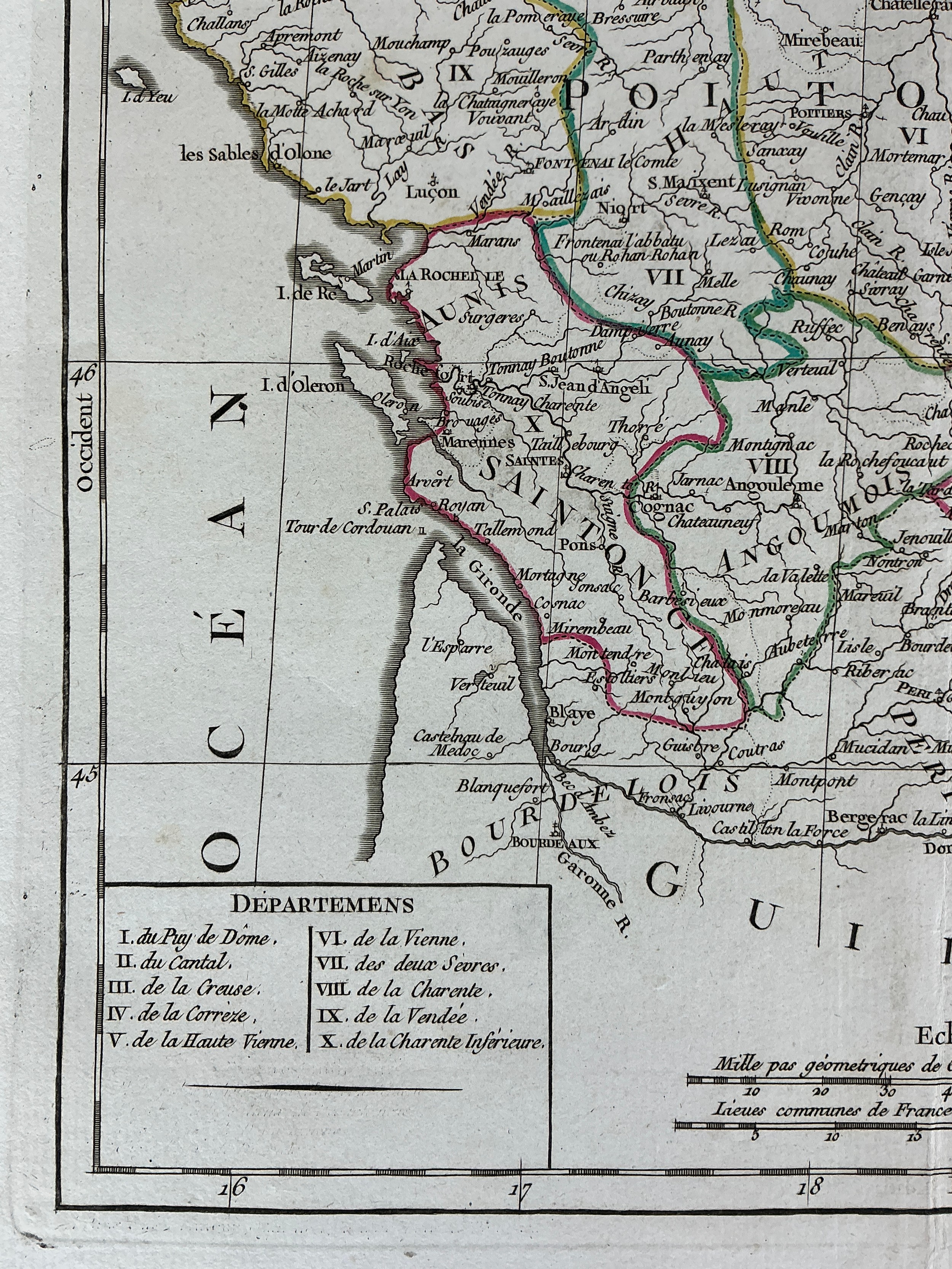
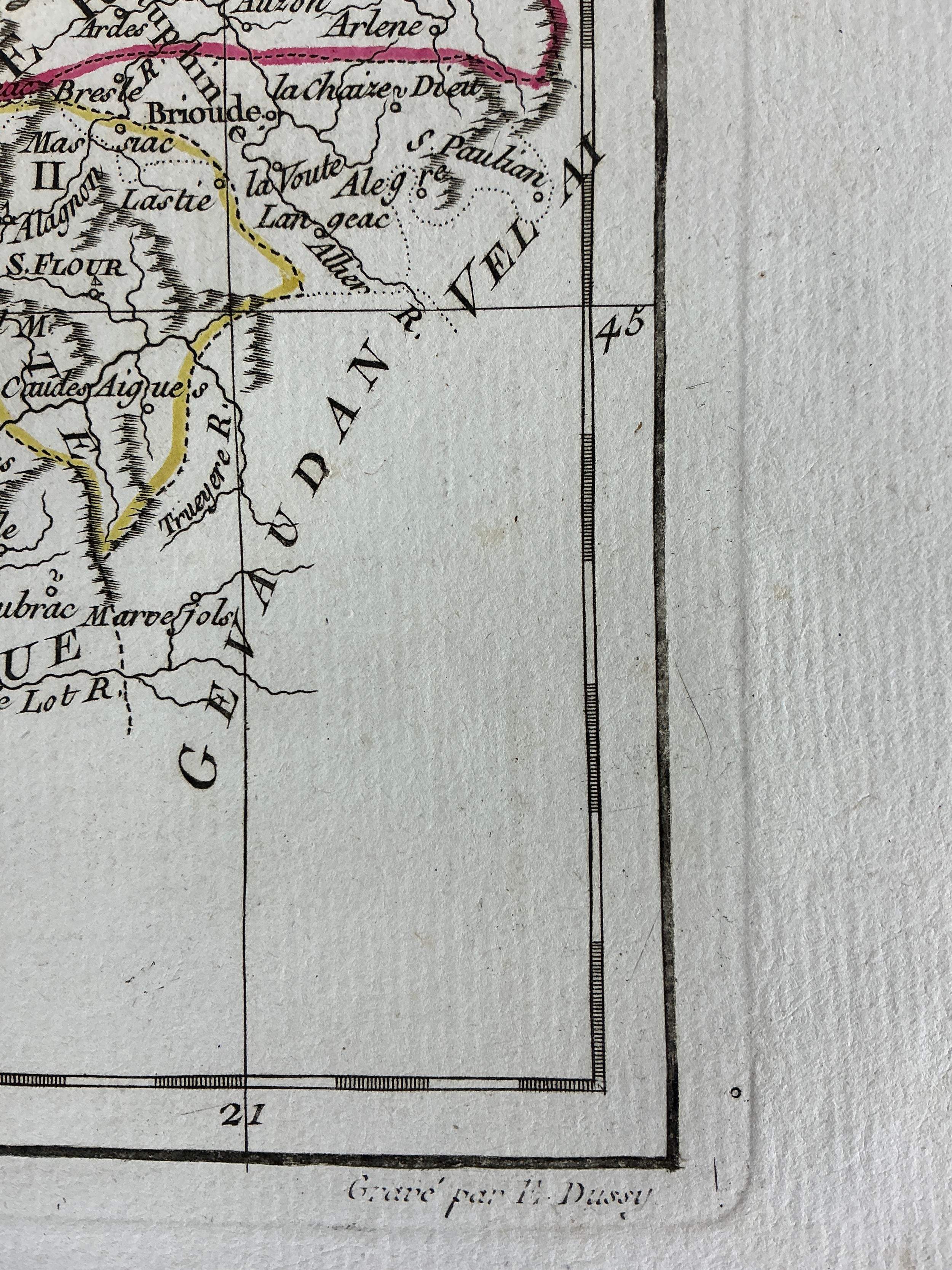
1806 French Engraved and Hand Coloured Map of Poitou Aunis, Saintonge, Angoumois, Limousin and Auvergne, by Cartographer Robert de Vaugondy 1806 -, revised by C.F. Delmarche.
Napoleonic Period regional Map.
Fees apply to the hammer price:
Free Registration
26.4% inc VAT*