£180
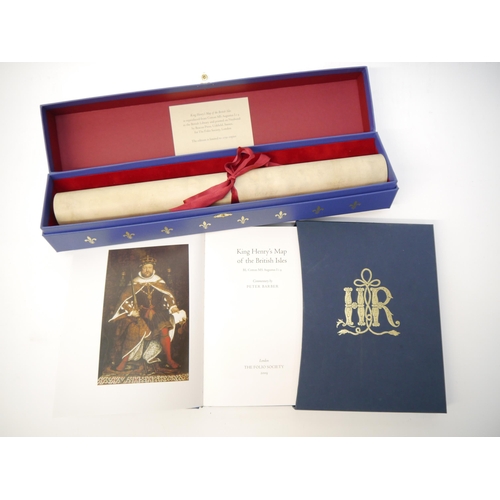
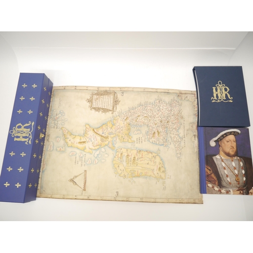
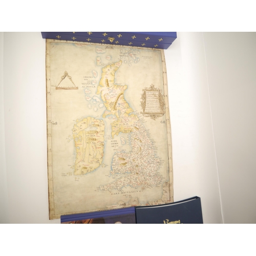
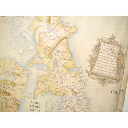
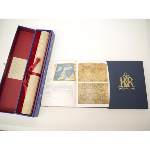
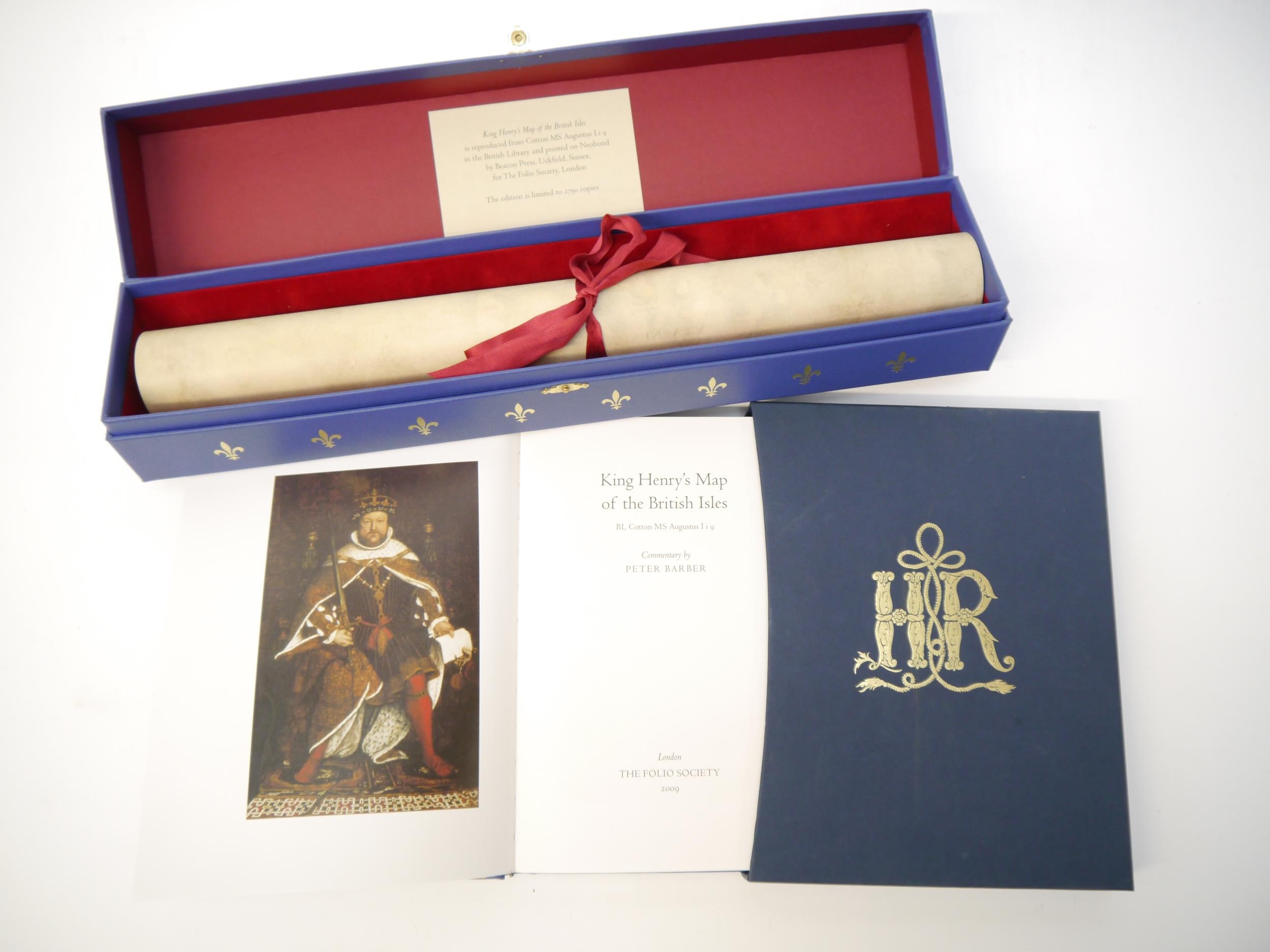
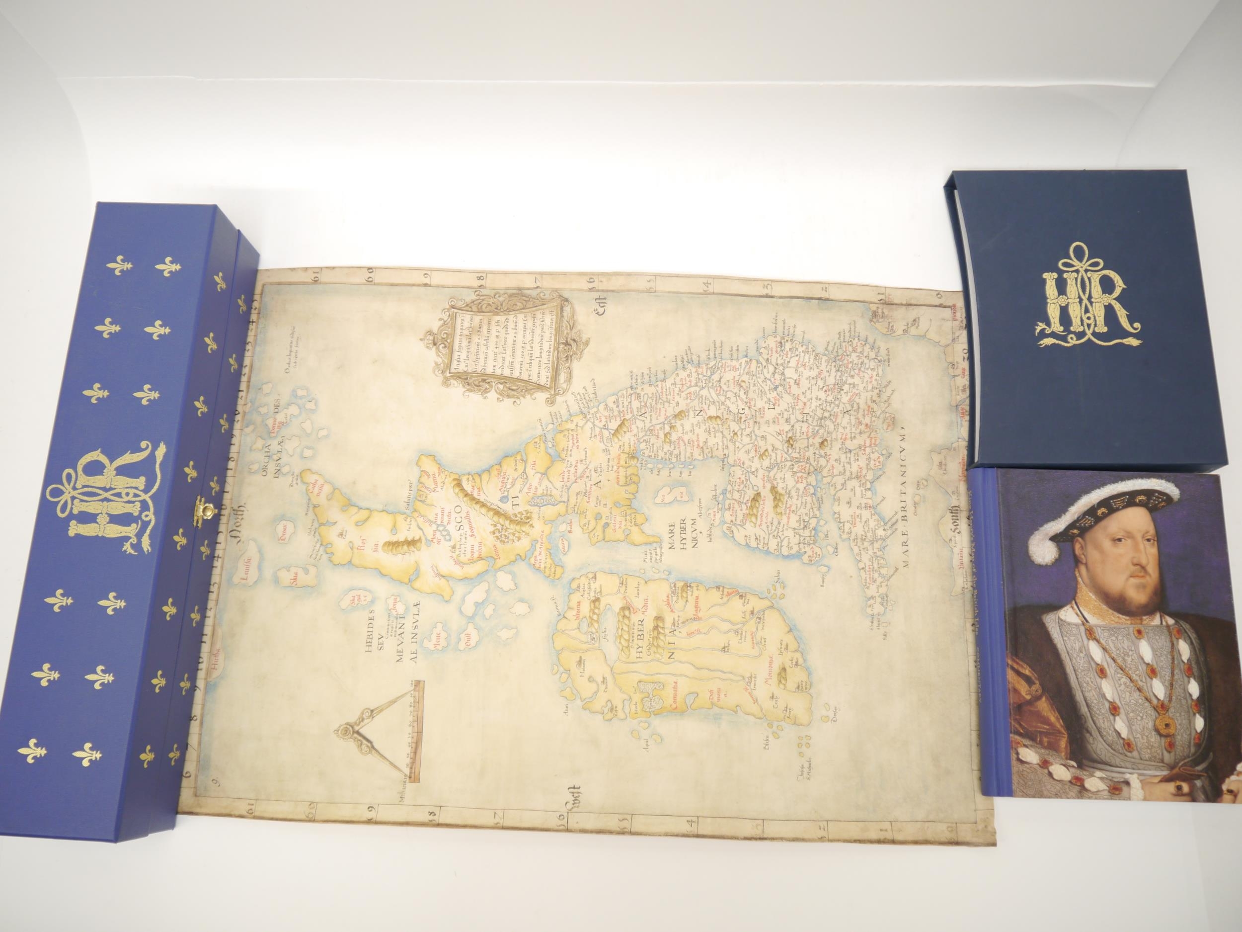
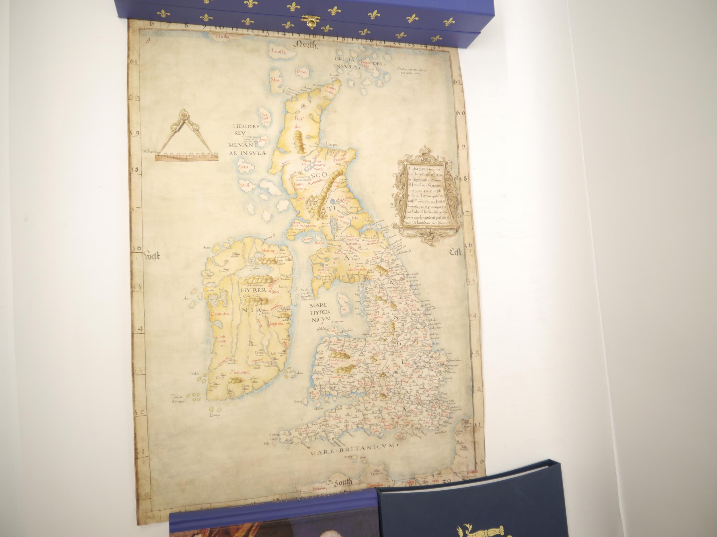
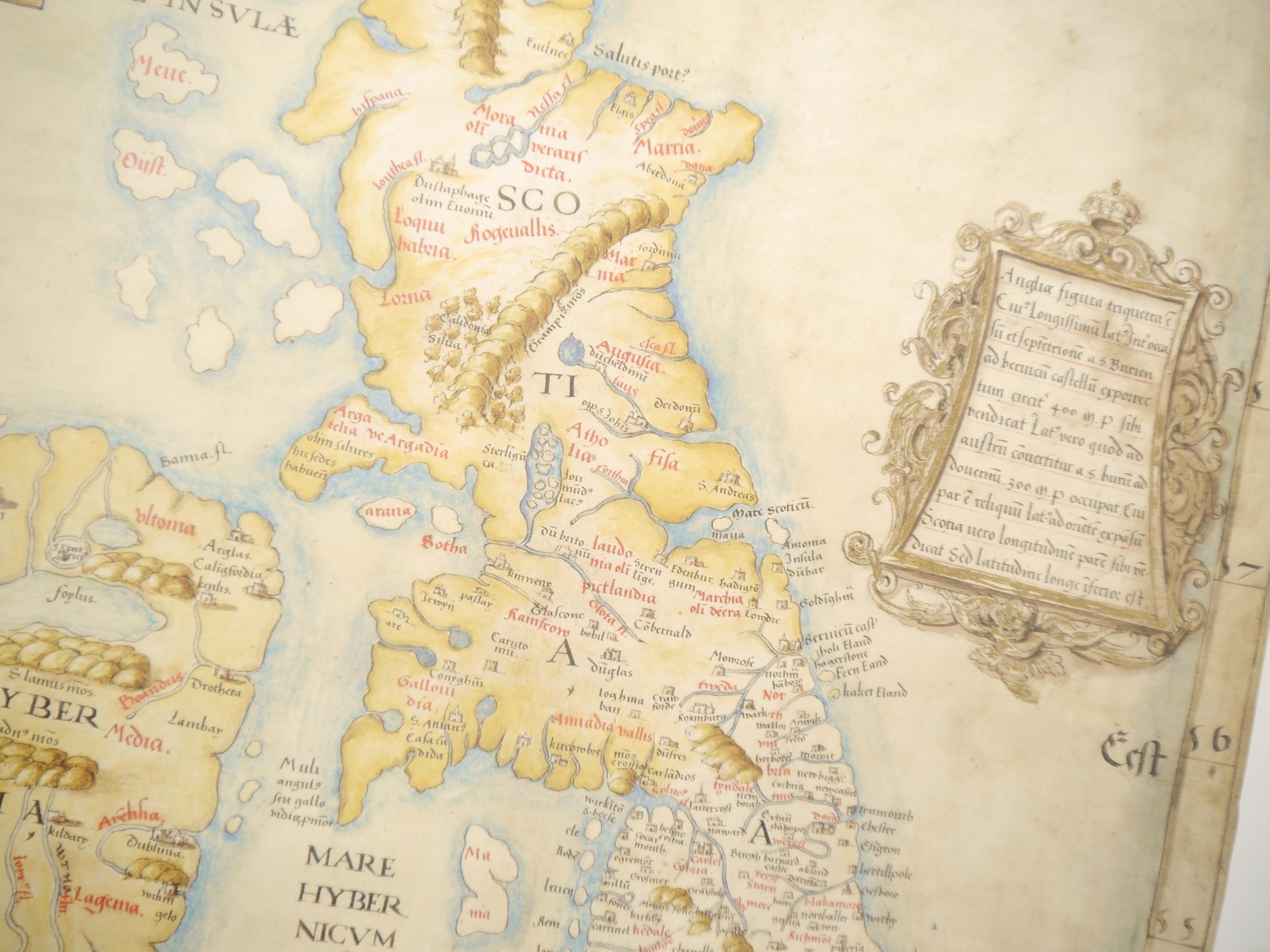
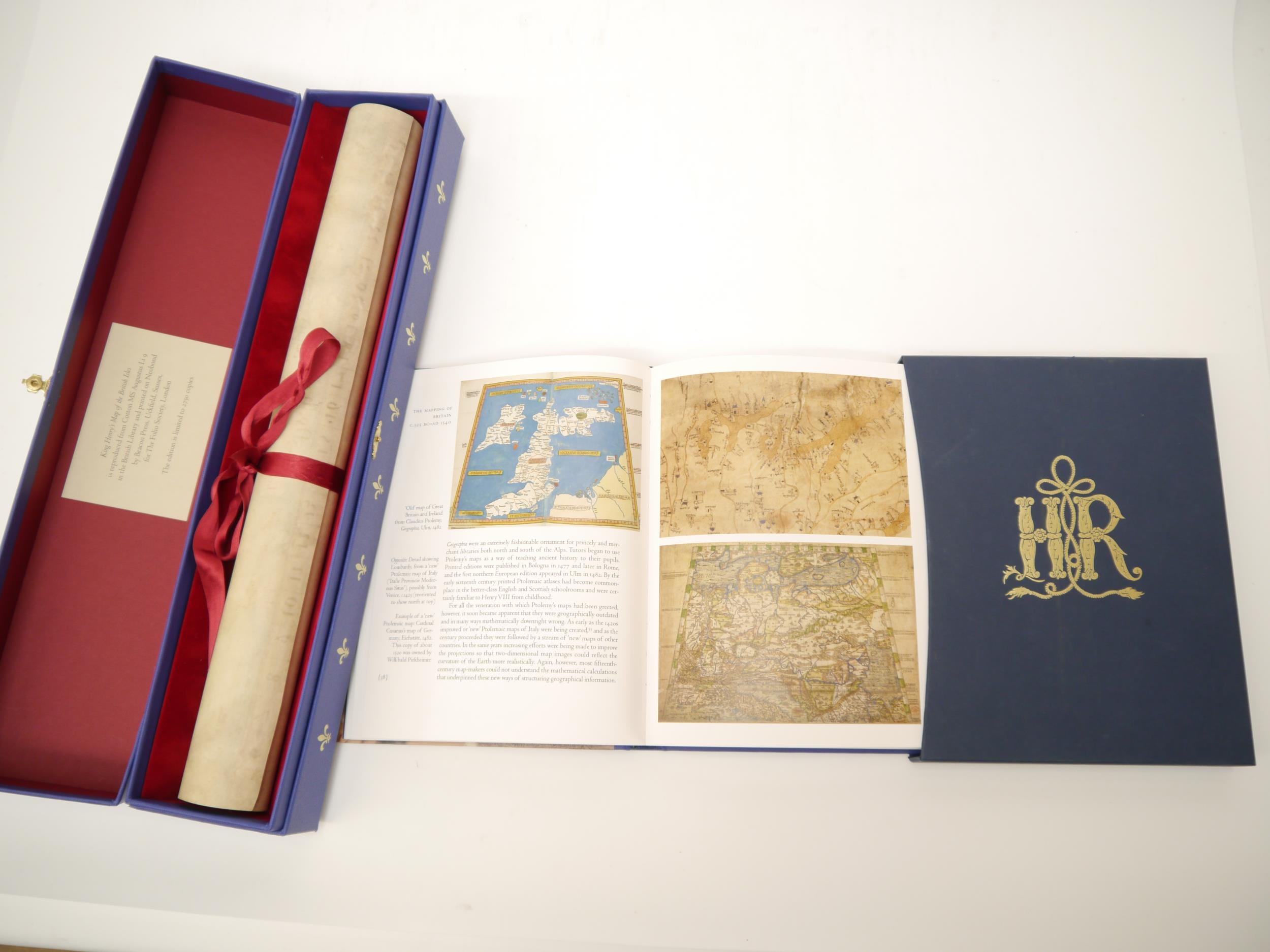
'King Henry's Map of the British Isles', The Folio Society, 2009, limited edition (2,750), facsimile map, reproduced from Cotton MS Augustus I.i 9 in the British Library and printed on Neobond (a high quality simulation vellum), approx size 63 x 46cm, silk ribbon tie, housed in original velvet lined decorative blue cloth gilt map box, printed paper label inside lid, metal clasp, together with the companion commentary volume by Peter Barber, Folio Society, 2009, 48 colour illustrations (of which 3 double page) as called for, original pictorial cloth gilt, slipcase. A Superb Facsimile of the King's personal map, produced by the Folio Society to commemorate the quincentenary of Henry VIII's accession. This historic map of Britain, Angliae Figura, hung on the walls of Hampton Court Palace, where its owner, King Henry VIII, would have consulted it frequently. Now a treasure of the British Library, it is the most important manuscript map of Britain created during Henry's reign. (2)
Fees apply to the hammer price:
Free Registration
21.6% inc VAT*
Flat Fee Registration
18.00% inc VAT*